Location of Sumbawa on a Regional Scale
Daytime January Blue Marble Map
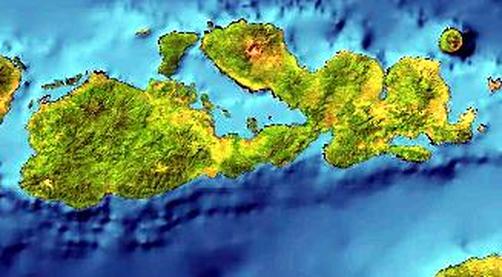
The average temperature in Sumbawa is 22 degrees Celcius, however this is the average of the year-round temperatures that include the dry and wet seasons. Sumbawa's dry season is from around Novermber to April and its wet season is approximately between May and October. The highest temperatures are experienced in April, September, October and November. The lowest temperatures are experienced in August. The wettest month is in January, where the driest months are in July and September.
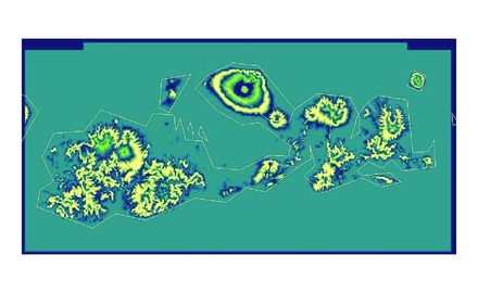
Elevation Map
This elevation map shows the increase of elevation levels from the sea to the inner areas of the island. The thin outline within the map indicates the outer edges of the island itself. Going from the outline inward, with each change in color, the elevation increases.
For example, the volcano in the northern-most part of the island can be easily seen. The various rings indicate rising elevations.
Mount Tambora is Sumbawa's volcano on active composite volcano made up of layers of lava and ash that has hardened. It is located on the northern peninsula of the island and has an elevation of 9,350 feet. It has one of the tallest peaks among the Indonesian islands and in 1815 is has the largest recorded eruption in European history.
